

· AFX Research, LLC
How Land Gets Identified in the Public Record, and Why It Drifts
A street address is not a legal description, and an old description stops matching the ground. What actually identifies a parcel, and which document answers which question.
Table of Contents
Before anyone can search a property, somebody has to say which property. That sounds trivial and it is the source of a surprising amount of trouble, because the identifiers people use in conversation are not the ones the record uses, and the ones the record uses were written at a moment that has since passed. Getting this right is most of what a search needs from you.
Four ways land gets described
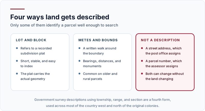
Lot and block refers to a recorded subdivision plat. It is short, stable, and easy to index, and the actual geometry lives on the plat rather than in the deed.
Metes and bounds is a written walk around the boundary, using bearings, distances, and monuments. It is the older form and still the normal one on rural and unplatted land.
Government survey descriptions, using township, range, and section, cover most of the country outside the original colonies and describe land by its position in a national grid.
And then the two that are not descriptions at all. A street address is assigned by the post office. A parcel or assessor’s number is assigned by the taxing authority for its own convenience. Both are useful for finding a property and neither defines it, and both can change while the land stays exactly where it is.
That last point is the one worth holding on to. An assessor can renumber a parcel after a reassessment, a city can renumber a street, and neither event conveys or changes a square foot of land. The description in the deed is what moved when the property last changed hands, and it is what the next deed will carry forward.
Why an old description drifts
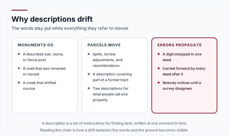
Monuments disappear. A description calling to an oak, a stone, a fence post, or a road that has since been renamed or rerouted was perfectly precise when written and is now partly a historical puzzle. Creeks move.
Parcels move too, in the sense that they get split, adjusted, and recombined. A description may cover part of a tract that no longer exists as a unit, and what everyone calls one property can turn out to be two descriptions that were never formally merged.
Errors propagate. A digit mistyped in one deed gets copied forward by every deed after it, and nothing surfaces until a survey disagrees with the paper. Reading the chain is how that becomes visible, which is one of the arguments in how far back a search should go.
The description and the survey do different jobs
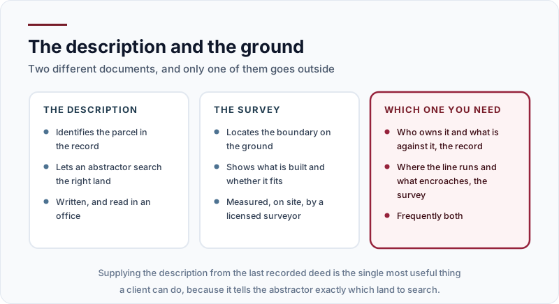
The description identifies the parcel in the record, which is what lets an abstractor search the right land. It is written, and it is read in an office.
The survey locates the boundary on the ground, shows what is built and whether it fits, and is measured on site by a licensed surveyor.
So the practical rule is short. Questions about who owns it and what is recorded against it are answered by the record. Questions about where the line runs and what encroaches are answered by a survey. A good many situations need both, and the two are not substitutes at any price.
Where they disagree, that disagreement is itself the finding. A description that closes on paper but does not match a surveyed boundary usually means something happened between the two, a split that was never properly described or an error copied forward, and identifying which one is a job for the chain rather than for either document alone.
The takeaway
Send the legal description from the last recorded deed rather than the address, because it tells the abstractor exactly which land to search. Expect an older description to have drifted from the ground it describes, and add a surveyor when the question is about location rather than ownership. Find the property that runs your search, or tell us what you are trying to establish and we will point you at the right one before anything is ordered.